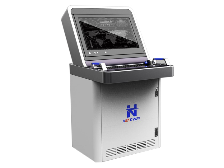
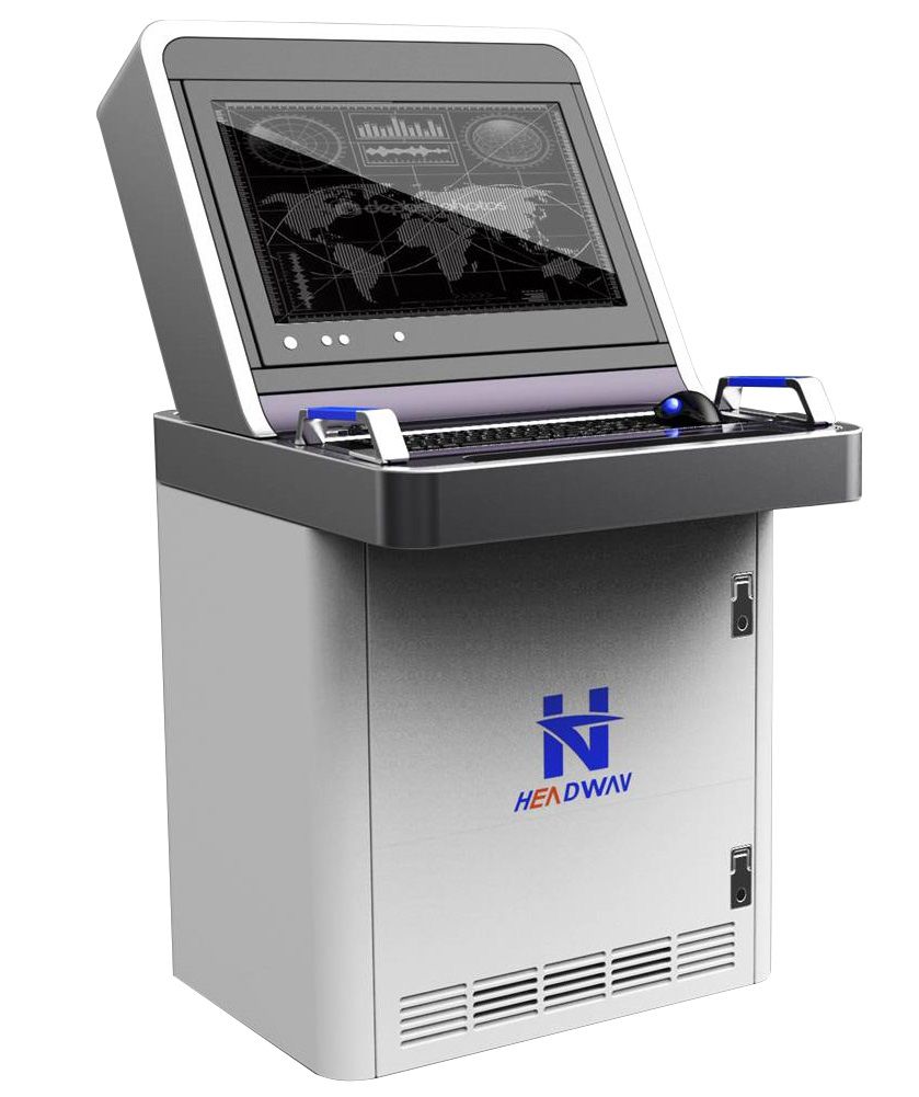
ECDIS - Electronic Chart Display and Information System - Nautical Digital Equipment 。
Introduction:
Headway® ECDIS is developed strictly according to IEC, IMO and IHO requirements and specifications.
The system is able to combine with AIS, GPS, ARPA, Gyro Compass, Speed Log, Echo Sounder, Autopilot and other communication and navigation equipments, so as to deal with varieties of information, including maritime geography, sailing states of this vessel, navigation environment and dynamics of a number of target vessels. It can realize functions of navigation, collision-avoidance assistance and route management of vessels, could be widely used in a variety of large and medium sized vessels, which greatly ensures the safety of vessel’s voyage, and markedly improve operational efficiencies.
Function Introduction:
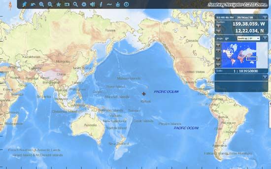
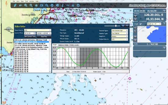
1、Chart Support
Being compatible with C-MAP Global Chart and in accordance with IHO-S57/S63 standard; Display function complies with IHO S-52 rules.
2、Multiple Functions
1) Auxiliary Navigation
Auxiliary navigation can be realized according to the established routes, acoustic and light alarms can be generated timely for dangerous states, meanwhile, real-time searching of various information of the current vessel and its surroundings could be performed.
2) Object Collision-Avoidance Alarms
Combining AIS, APRA to achieve collision-Avoidance assistance alarms.
3) Navigation Administration Layout of Routes & Management of Tracks, Automatic Recording of Log.
4) Expansion function
Ready access to information of the current vessel and its surrounding vessels via the ground center, which can monitor a number of vessels at the same time; restore the current states of the vessel and its surroundings.
5) Chart Information Inquiry
Searching any positions of Chart, including sea-route, water-depth, ocean-current, object-mark, etc.
6)Chart Quick Zoom
7) Chart Update
Being able to manually add the temporary object-mark and realize automatic or manual chart updates remotely or locally.
8) Multiple Display Modes
Different display modes could be selected as per demands, e.g. dusk, night, daytime.
9) Perfect Accidental Power-Off Protection
Preventing losses caused by accidental power-off.
3. Easy Operation, Simple Interface, helpful for crew to grasp.
Standard:
IMO Resolution A.694(17)
IMO-Resolution A.817(19)
IHO S-52 /S-57/S-63
SOLAS Regulation V/18.1, V/19.2.1.4, V/19.2.1.5
IEC 61174 (2008)
IEC 60945 (2002)
IEC 61162